
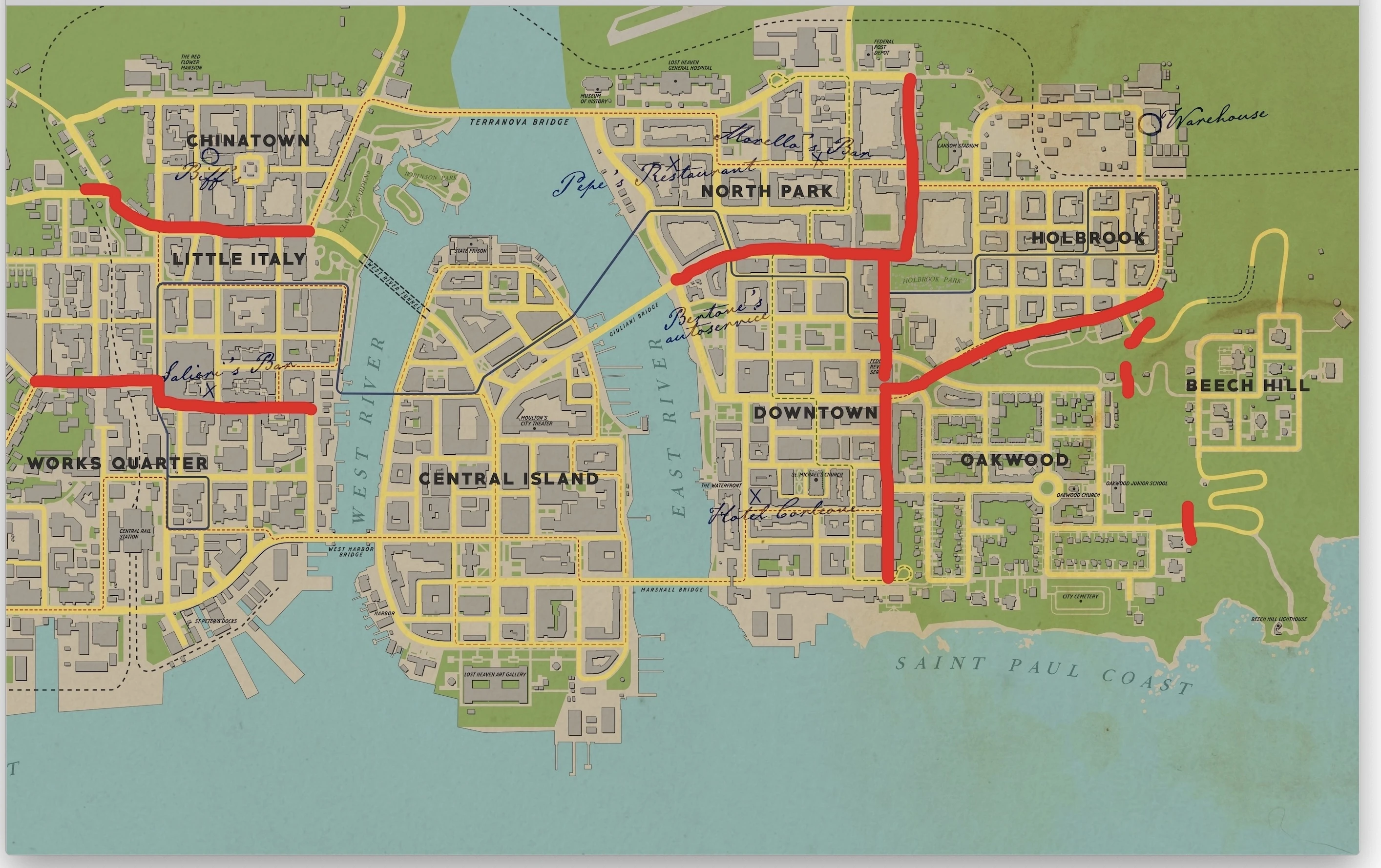
Well I think I've figured out where the district boundaries are meant to be. I drove around the city while being chased by the cops, and from the police radios I was able to draw boundaries for most of the districts on the map. I was about to upload the image, but for some reason MediaWiki doesn't like the image editing software I used.
I propose that we make a map image with these boundaries and use it to determine which district locations are in when there's any doubt. We could also use it to sort collectibles and wanted posters by district. The boundaries for Central Island would be somewhere over the water on the bridges.
Looks good to me. The only collectibles that should need to be listed by district might be the wanted posters, depending on how many there end up being.
I still need to try out the boundary between Downtown, Oakwood, and Holbrook some more. I also noticed it says you're exiting city limits almost immediately off the main road, but I think the adjacent buildings up north should count as being part of that district.